Introducing Fire Trak: The Next Generation in Forest Fire Management tool set by Unmanned Systems Research (USR)
In the face of increasingly unpredictable and devastating forest fires, Unmaned Systems Research developed FireTrak—a cutting-edge solution designed to revolutionize how we analyze and detect forest fire hotspots.

Discover the Power of Precision with Radiometric Thermal Imaging
FireTrak harnesses the unparalleled accuracy of Radiometric Thermal imaging to detect forest fire hotspots by accurately measuring surface temperature variations with high sensitivity.
This allows for the detection of even small, smoldering hotspots not seen my the human eye. These small hotspots could potentially grow into larger fires if left undetected.
This technology pinpoints heat signatures with precision, enabling first responders to react swiftly and effectively, safeguarding both natural ecosystems and communities.

Fire Trak vs Cloud Based AI Programs
Unlike cloud based fire AI tools FireTrak is local on your PC, this provides a multitude of benefits. The processing of Radiometic Thermal Imagery is completed faster and without a need for internet connection. Data is secured locally which provides fire investigators with peace of mind regarding sensitive information. FireTrak also allows you to select quantitive temperature thresholds allowing full control over what appears as a hotspot (target) after processing.
FireTrak
vs
Cloud Based AI
-
Analyzing Radiometric Data (RJPEG)
-
Fast Processing
-
Accurate Geolocating
-
Secure Data (Local Storage)
-
Temperature Threshold Selection
-
Instant export CSV, KML Files and QGIS project files. (Not Downloaded)
-
Longer Processing times.
-
Less options for security and encryption of your data.
-
Unable to fully analyze the radiometric data for hotspot verification.
-
Uses RGB Thermal JPEG vs the full radiometric data (RJPEG)
Seamless Integrations with GIS platforms
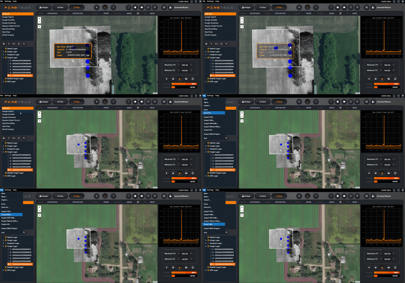
FireTrak offers the ability to export CSV, KML and QGIS project files. These can be easily integrated into GIS software such as QGIS and into ESRI/ArcGIS platforms. This ensures that data is not only accurate but easily accessible, facilitating real-time decision-making and strategic planning across different agencies and stakeholders.

Key Features & Benefits

-
Early Detection: Identify potential fire hotspots before they escalate.
-
Accurate Geolocation: Pinpoint fire locations with exact coordinates for targeted intervention.
-
Fast Data processing: After finishing your thermal mapping mission, processing the data takes just a few minutes. The steps to analyze and view targets, as well as prepare the map for processing, are straightforward and efficient.
-
Temperature Threshold Selection: Ensure precision by controlling what appears as a hotspot in the processed data
-
Data Security: Keep your images and data local, Non-cloud based.
-
KML, CSV and QGIS Project Export: Export data easily directly from FireTrak


-
Multi-Sensor Support: Compatible with a wide range of thermal sensors for maximum flexibility and versatility in data collection. If your Sensor is not on the list it may be added, contact us for more details.
H20T / H20N / XT2 / M2EA / M30T / M3T
Who Can Benefit from FireTrak?
-
Government Agencies: Offering state-of-the-art tools for forest and national park management teams.
-
Environmental Organizations: Providing critical data for research and conservation efforts.
-
Firefighting Units and Emergency Responders: Equipping responders with precise information for effective firefighting strategies.
-
Industry and Contractors: Enables fast data processing for quick and efficient detection of hotspots, ideal for contractors engaged in wildfire hotspot detection.
-
Academic Institutions: Offering advanced technologies for studying and understanding wildfire behaviour.
PRICING
FireTrak
Wildfire Mapping
$1199.99
CAD/Annual
*Single Licence*
Unrestricted Trial Licence Available
H20T / H20N / XT2 / M2EA / M30T / M3T
NOTE: Currently only works with DJI, other sensors coming soon.

FireTrak offers advanced thermal mapping technology, giving users precise, and secure data to efficiently combat wildfires.
Contact us today to learn more about how FireTrak can integrate into your forest fire management strategy and help you make a tangible difference in your emergency response efforts.


